◀ LEGACY MODEL
Traditional Satellite Pipeline
Capture raw imagery on orbit
Queue at terrestrial data center
Analyst review & tasking
Time to insight HOURS – DAYS · ~550 ms relay
On-orbit AI inference for sovereign maritime domain awareness, bridging terrestrial sensors and orbital telemetry into decision-ready intelligence directly from orbit, in minutes, not days.
From days-old pixels to instant, decision-ready intelligence, the moment intelligence is created moves from the ground to the orbital bus.
In defense and disaster response, a threat detected a day late is a mission failure. Nodeflux moves the inference loop from the ground to the satellite, turning gigabytes of pixels into kilobytes of decisions, delivered in the same orbital pass.
Heavy training stays on the ground. Inference moves to orbit. Optical links keep data off foreign soil.
Train on the ground. Infer in orbit. Downlink only what matters: a sovereign data path where classified imagery never transits foreign ground stations.
Persistent overhead surveillance and maritime domain awareness are the only credible answer to non-cooperative targets across one of the world's largest Exclusive Economic Zones, and the same AI capability serves disaster response, food security, and environmental missions.
17,000 islands. 3 million km² of EEZ. No ground network can watch it continuously, and AIS-spoofing “dark vessels” are designed to disappear from the ones that try. One capability, many national missions.
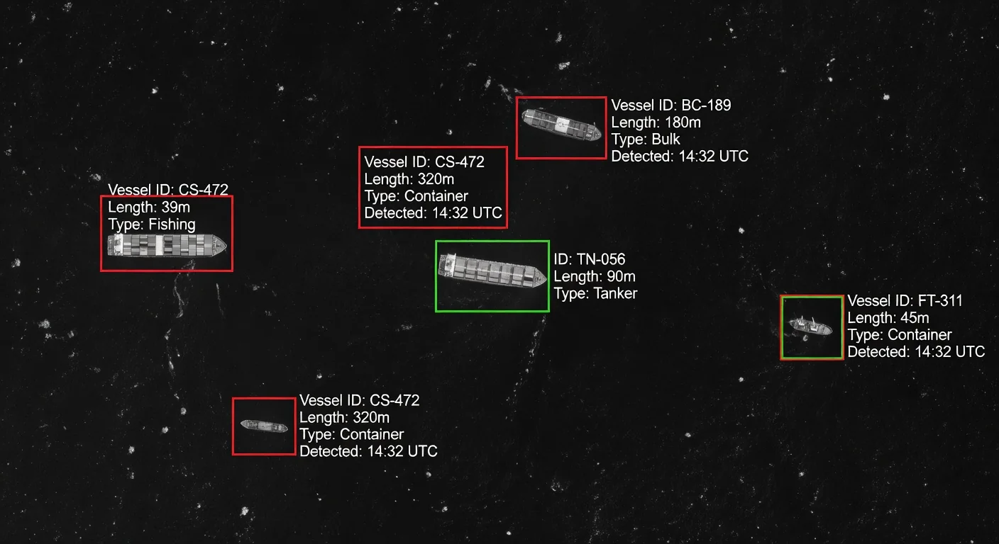
Millions of km² of EEZ to monitor continuously.
Persistent overhead detection of non-cooperative vessels.
Crop yield, deforestation & ESG monitoring at national scale.
Earthquake/flood damage assessment, illegal mining, urban planning.
Cloud-penetrating Synthetic Aperture Radar paired with space-rated AI accelerators turns raw radar returns into geolocated targets in minutes.
Equatorial cloud cover blinds optical satellites where it matters most. SAR sees through the weather, and Nodeflux runs the interpretation on-orbit, so only coordinates and classifications come down. Interceptors dispatch in minutes, not days.
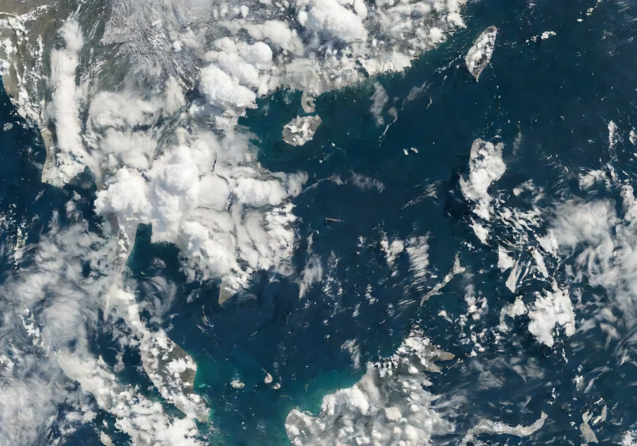
Persistent equatorial cloud cover renders traditional optical satellites blind for large parts of the day, exactly when illegal activity peaks.

SAR penetrates cloud day and night, exposing dark vessels and coastal incursions, but at the cost of compute-heavy interpretation.
Orbit imposes brutal physics, but the silicon curve and the market are bending sharply in our favor.
Rad-tolerant AI accelerators are shipping. The orbital AI market is tripling this decade, with Asia-Pacific leading the growth. The window to lead is now.
Vacuum cooling = radiation only. AI radiators stretch size, weight & power envelopes.
High-energy particles flip bits and degrade COTS silicon over mission lifetime.
Larger panels = larger target against 1M+ tracked debris objects in LEO.
Classified data must never transit foreign ground stations; process it in orbit.
Space infrastructure rewards specialization. Nodeflux brings the sovereign Vision AI brain and partners with best-in-class satellite builders to deliver an end-to-end orbital ISR capability.
We don't build everything; we build the right alliances. Nodeflux × XDLINX pairs end-to-end small-satellite engineering with sovereign Vision AI, with technology transfer and local sourcing built in.

An MoU-anchored partnership to deliver sub-2 m, multi-spectral ISR for Indonesia, with a technology-transfer framework and locally-sourced components per government mandate.
Maritime & border security, disaster response, food & agriculture, mining oversight, environmental sustainability: actionable intelligence streams, not raw pixels.
Speak to Nodeflux about integrating Space-Edge Vision AI into your maritime security, defense, disaster response, or environmental monitoring programs.